When World Meteorological Organization (WMO) officials announced that climate models are "strongly aligned" on a major shift, the message was clear: the neutral phase is over. As of mid-April 2026, the equatorial Pacific Ocean has officially exited its La Niña chill and is rapidly heating up. The twist? This isn't just any warm-up. Experts warn we could be facing a "super" El Niño by late 2026—the strongest on record.
Here's the thing: this isn't some distant theoretical scenario. It's happening now. Subsurface heat content is building fast, and the odds of El Niño forming between May and July 2026 have skyrocketed to nearly 98%. For farmers, city planners, and anyone worried about winter weather, the implications are immediate and massive.
The Numbers Don't Lie
Let's look at the data. On April 9, 2026, the Climate Prediction Center (CPC), part of the U.S. National Weather Service, issued its final La Niña advisory. They didn't mince words. They declared an "El Niño Watch" with an 80% chance of neutral conditions persisting through June, but a 61% chance of El Niño emerging by July. By late summer, that probability jumps to near certainty.
But wait—it gets more intense. The International Research Institute for Climate and Society (IRI) at Columbia University ran their CCSR/IRI ENSO plume forecast. Their numbers are staggering: a 70% chance of El Niño in April–June 2026, rising to 88–94% for the rest of the year. Meanwhile, independent analysis citing National Oceanic and Atmospheric Administration (NOAA) data suggests the odds of a "super" event—defined as sea surface temperatures hitting 2°C or more above average in the Niño 3.4 region—have jumped from 25% to 37% in just three weeks.
Why does this matter? Because temperature anomalies aren't just abstract numbers. A "normal" El Niño peaks around 0.5° to 1°C above average. A strong one hits 1.5°C. American and Australian modeling systems are projecting anomalies between 2.5°C and 3°C by late 2026. That would break records set over the last 150 years.
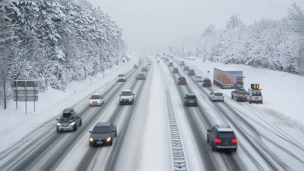
What This Means for Your Winter
If you're bracing for a harsh winter, think again. Historical analogs suggest a very different picture for the 2026–27 season. In the Northern Rockies and Northern Plains, expect reduced snowpack and fewer bitter cold snaps. Sounds nice? Maybe not. Snowpack is critical water storage for millions of people downstream.
In the Eastern United States, the signal is even clearer: warmer, typically less snowy winters. But the real drama unfolds on the West Coast. California and the Desert Southwest face elevated chances of above-normal precipitation. This could mean drought relief for parched areas in Arizona and California. However, there's a catch. Increased rain in regions recently burned by wildfires raises significant flood risks, especially in those vulnerable burn scars where soil can't absorb the water.
Conversely, the Columbia River Basin, parts of Montana, Idaho, and Alberta may see drier conditions. This creates a paradox: too much water in some places, too little in others. Water managers in the Pacific Northwest are already looking at potential "tight irrigation allocations" extending through 2027 due to lower spring runoff.
Global Ripple Effects
This isn't just a North American story. Wilfran Moufouma Okia, Chief of Climate Prediction at the WMO, noted that land surface temperatures are expected to be above-normal nearly everywhere globally during the May–July 2026 period. The signal is especially strong over southern North America, Central America, the Caribbean, Europe, and Northern Africa.
The broader impacts are severe. Flooding remains a top concern, particularly in regions unprepared for heavy rains. Wildfire risk also spikes. Recent research links super El Niños to increased fire danger in the Northwestern United States, Australia, and Canada. It’s a vicious cycle: dry conditions fuel fires, then wet conditions cause floods in burned areas.
Hurricane patterns will shift too. El Niño typically suppresses Atlantic hurricane activity, offering a meaningful reduction in risk for Gulf Coast producers during the August–October window. But don't celebrate yet. Eastern Pacific hurricanes often increase during these events, shifting the threat elsewhere.
Timeline of Events
- Early April 2026: ENSO system enters neutral phase following the end of the 2025–26 La Niña.
- April 9, 2026: CPC issues Final La Niña Advisory and El Niño Watch; 61% chance of El Niño by May–July.
- Mid-April 2026: IRI forecasts 70% chance of El Niño in April–June, rising to 94% by year-end.
- May–July 2026: Projected onset of El Niño conditions; subsurface heat accumulates rapidly.
- Late 2026: Potential peak intensity; models project 2.5–3°C anomalies (Super El Niño).
- Winter 2026–27: Expected warm, wet conditions in Western US; dry conditions in Pacific Northwest.
Expert Analysis and Next Steps
The details are still evolving, but the direction is undeniable. "The question is not when or if it happens," says one analyst, "it's how strong." Over the next 3–4 months, forecasters will determine if this becomes a historic super event. For now, preparedness is key. Communities in flood-prone areas need to review drainage systems, while agricultural sectors in the Pacific Northwest must prepare for tighter water restrictions.
Frequently Asked Questions
What is a "Super El Niño"?
A Super El Niño occurs when sea surface temperatures in the Niño 3.4 region of the central Pacific exceed 2°C above average. This is significantly stronger than a normal El Niño (0.5–1°C) and leads to more extreme global weather patterns, including intensified flooding, droughts, and temperature anomalies.
How will this affect my local weather?
Impacts vary by region. The Eastern US typically sees warmer, less snowy winters. California and the Southwest may experience heavier rains and flood risks, especially in wildfire burn scars. The Pacific Northwest and parts of Canada may face drier conditions and reduced snowpack, affecting water supplies.
When will El Niño conditions begin?
Most models predict El Niño conditions will emerge between May and July 2026. The International Research Institute for Climate and Society assigns a 70% probability for this window, with confidence rising to over 90% for the remainder of the year.
Will this impact hurricane seasons?
Yes. El Niño typically suppresses Atlantic hurricane activity, reducing risk for the Gulf Coast during August–October. However, it often increases hurricane activity in the Eastern Pacific, shifting storm threats to other regions.
Is this event certain to happen?
While no forecast is 100% guaranteed, the consensus among major agencies like NOAA, WMO, and IRI is extremely high. The probability of El Niño developing by late 2026 is estimated at 98%, with a growing likelihood of it becoming a historic "super" event.